Fish in Tryon Creek
For more information about fish in Tryon Creek, including USFWS’ monitoring work, visit the Fish & Wildlife section of our About the Watershed page.
Fish Passage Barriers
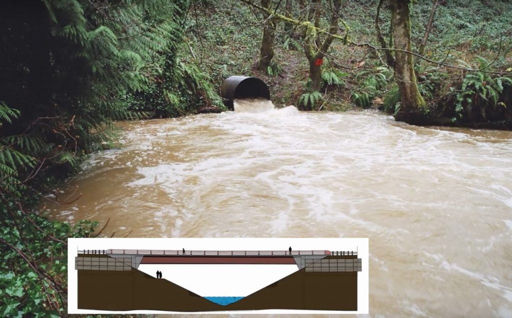
While the Tryon Creek watershed has high habitat quality, there are several physical barriers to fish passage throughout the watershed that prevent native fish from thriving. Tryon Creek Watershed Council advocates for removal of these fish passage barriers. Many culverts within the watershed are difficult or impossible for fish to pass through. In 2014, Tryon Creek Watershed Council led a project to remove the Stone Bridge culvert, a fish passage barrier located within the Tryon Creek State Natural Area and replaced it with the Nettle Creek Bridge. Many culverts remain throughout the watershed. The three biggest barriers to a thriving native fish population are the Boones Ferry Road culvert (now a Bridge!), the 4th Avenue culvert, and the Highway 43 culvert.
Nettle Creek Bridge
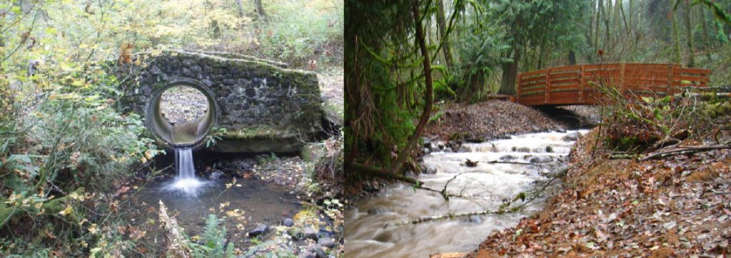
Before and After!
Boones Ferry Road Bridge
The small, aging culvert was an obstacle to water flow and fish and wildlife passage. This exciting project was achieved during 2020 and early 2021 after many years of planning and advocacy. Learn more at the BES project page, or watch a video below that talks about the impetus for the project and expected results.
TCWC was lucky to be in the loop as this project moved forward, and have been eager to support the establishment of native plants on-site. We were able to go on a project walk-through during construction (here) in November 2021, held a community planting with Friends of Tryon Creek and OPRD (here) upon project completion in May 2022, and 1 year post-project were able to tour the project with BES and provide additional restoration through Cascade Education Corps (here) – photos from all of these are in the slideshow below!
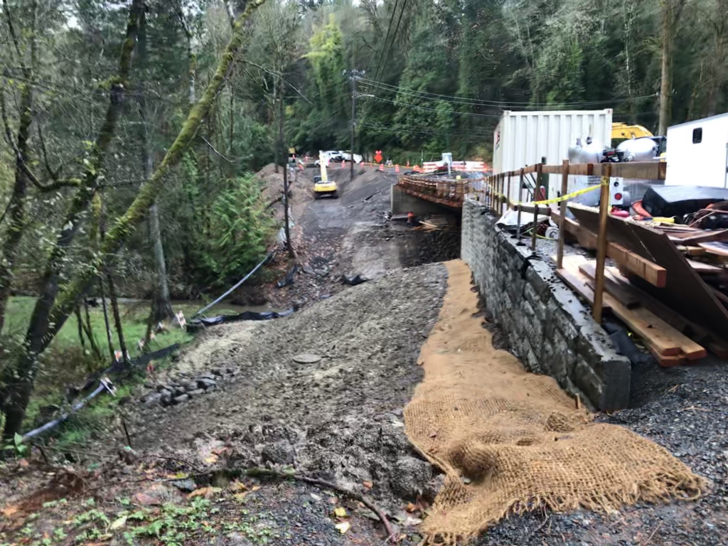
November 2020: Multi-partner tour during construction. The view facing South along Boones Ferry Rd 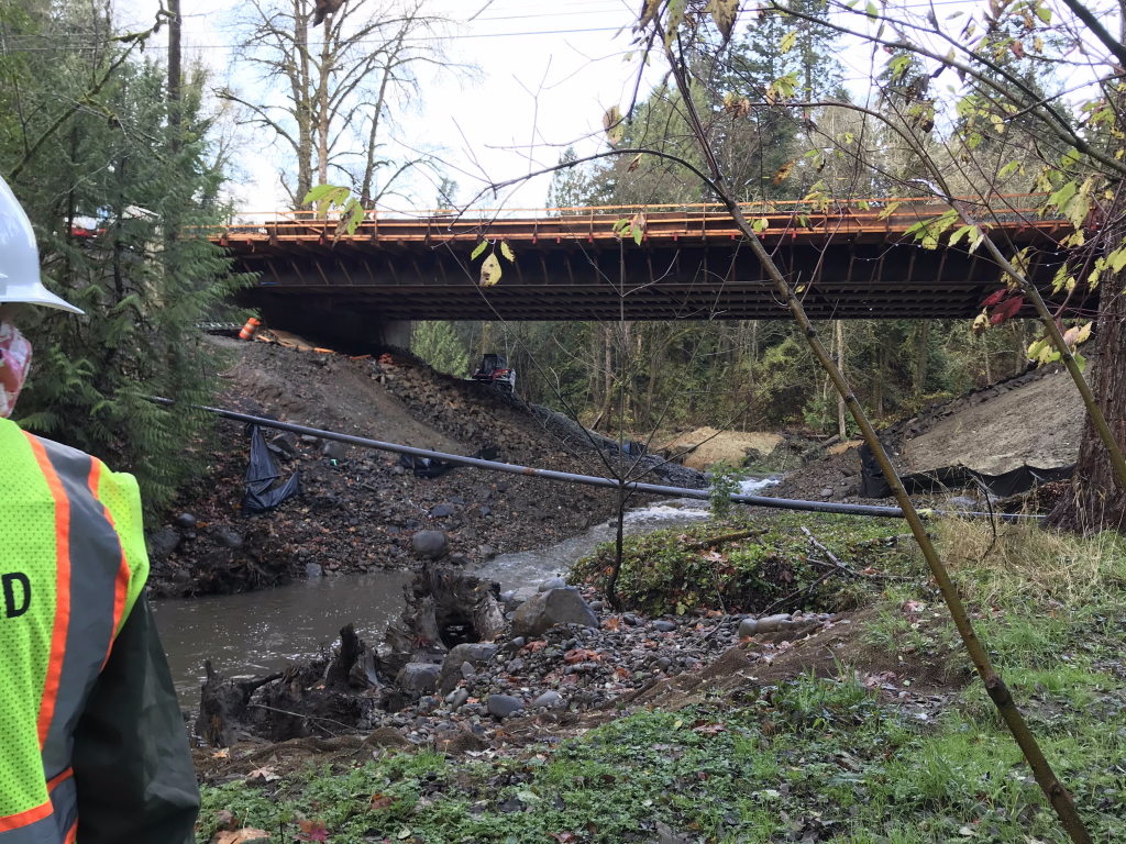
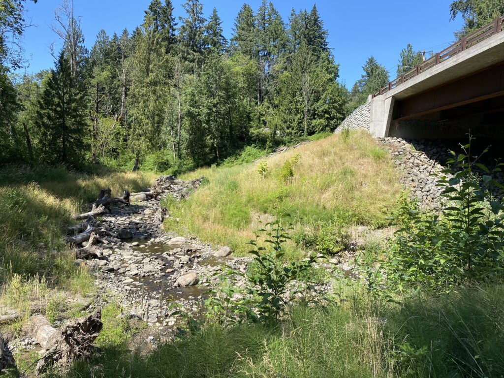
The main stem of Tryon Creek runs under the Boones Ferry bridge just past the confluence with Arnold Creek 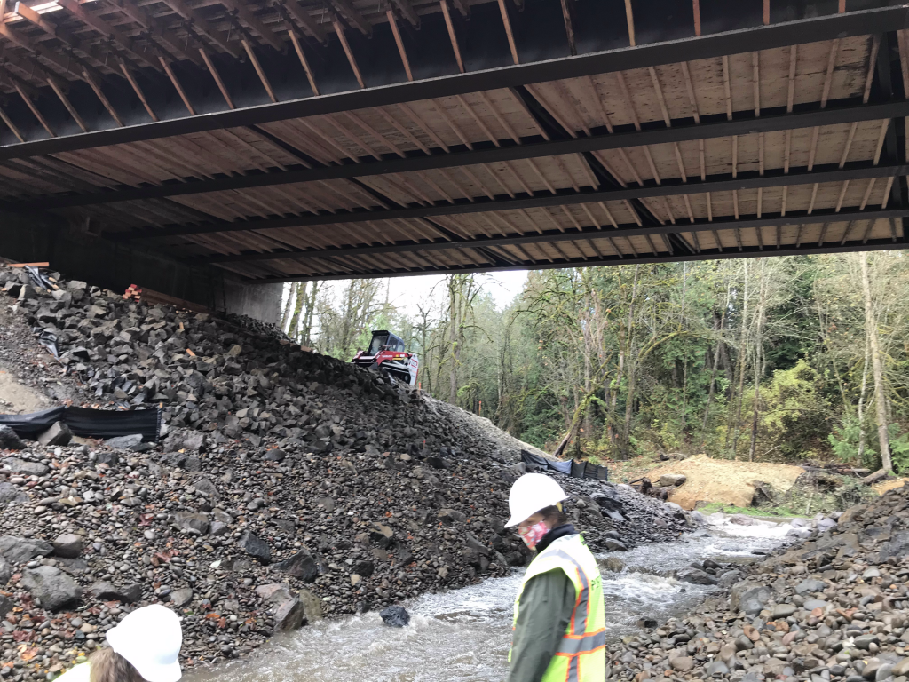
The main stem of Tryon Creek runs under the Boones Ferry bridge just past the confluence with Arnold Creek 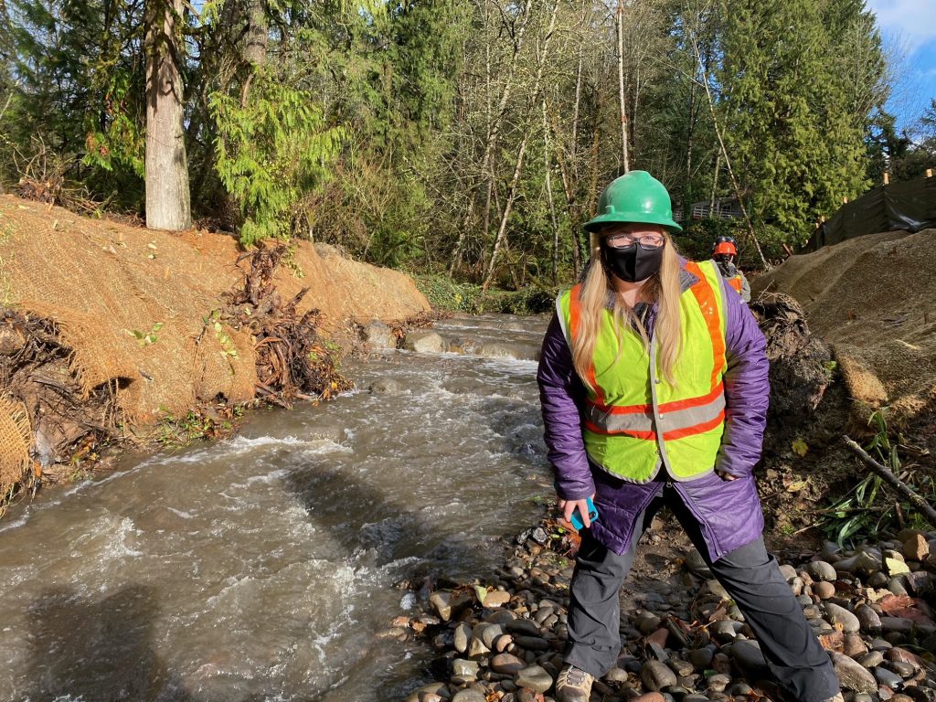
TCWC Coordinator Alexis 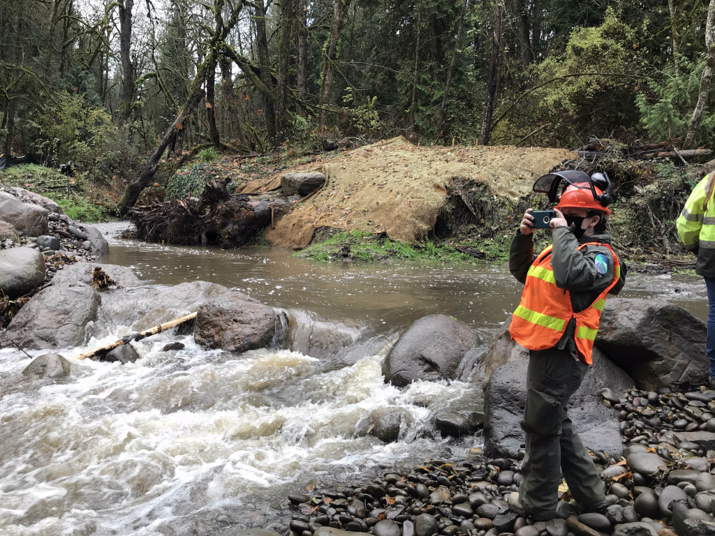
Arnold Creek (L) and main stem Tryon Creek (R) meet to flow under the Boones Ferry bridge 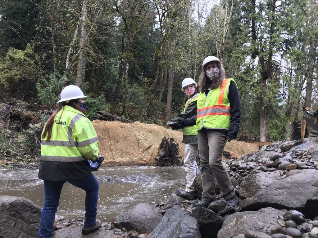
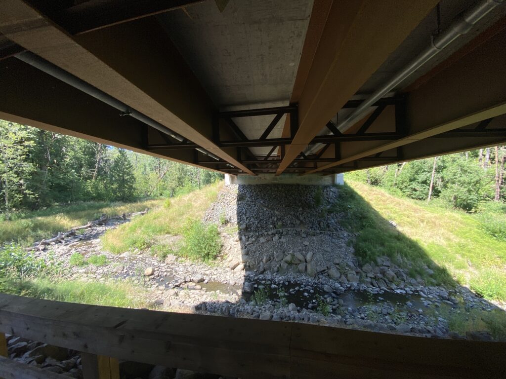
Along the main stem of Tryon Creek, weirs have been installed. The banks have coir matting which will be interplanted with native plants to stabilize soils and revegetate the creek corridor. 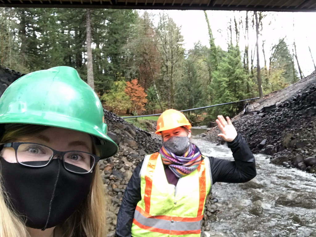
TCWC & FOTC colleagues waving hi 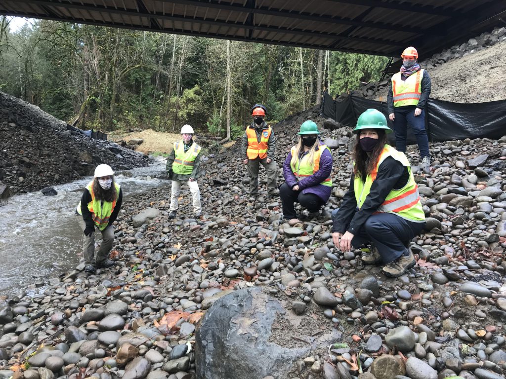
Group photo, from L to R: Jennifer Devlin (BES), Christa von Behren (BES), Nicole Geeting (OPRD), Alexis Barton (TCWC), Colleen Mitchell (BES), Amy Stout (FOTC) 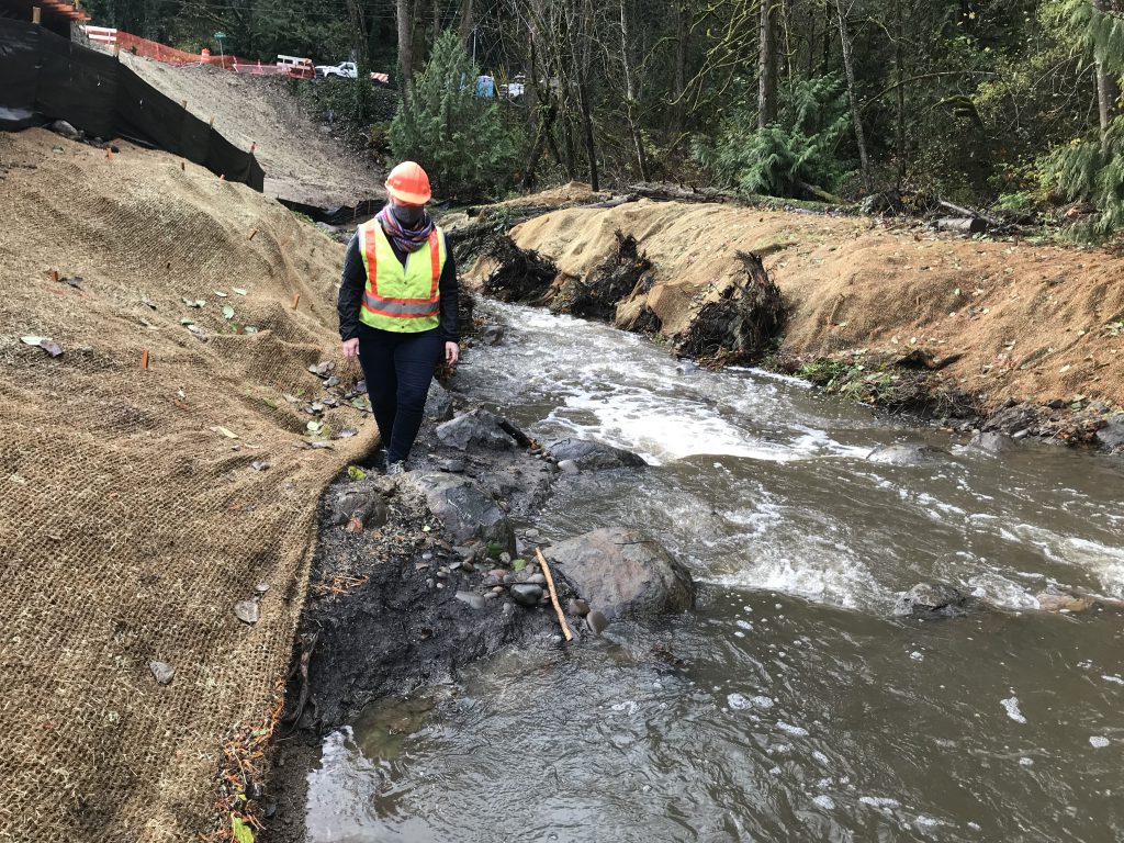
Along the main stem of Tryon Creek, weirs have been installed. The banks have coir matting which will be interplanted with native plants to stabilize soils and revegetate the creek corridor. 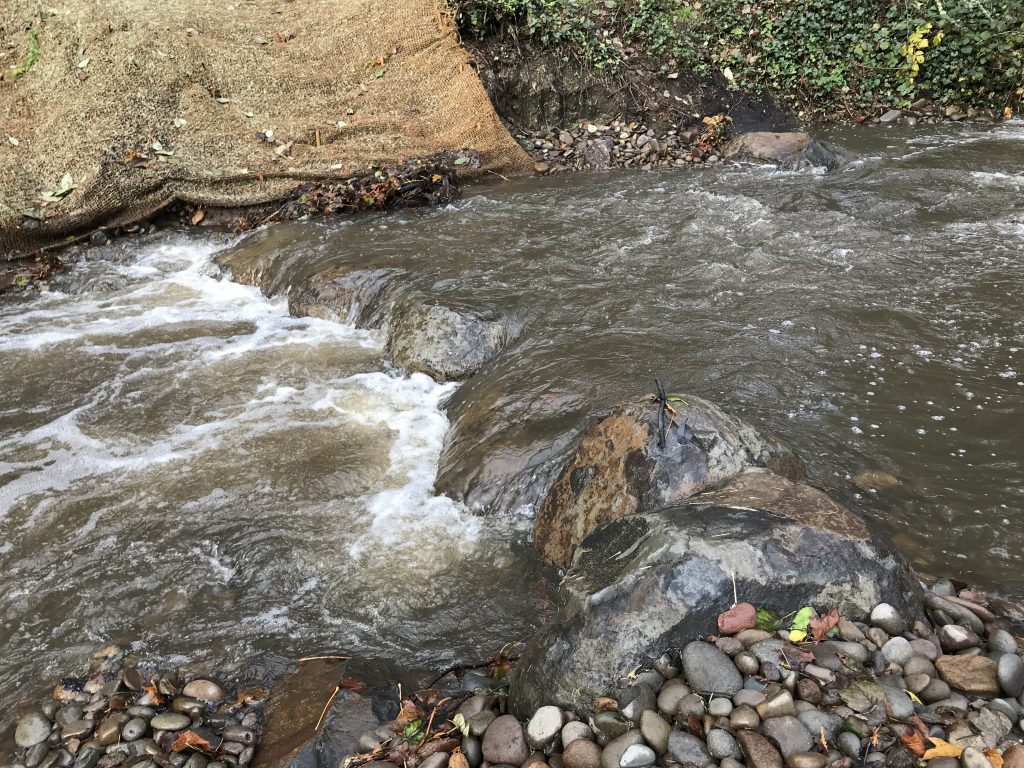
Main stem of Tryon Creek 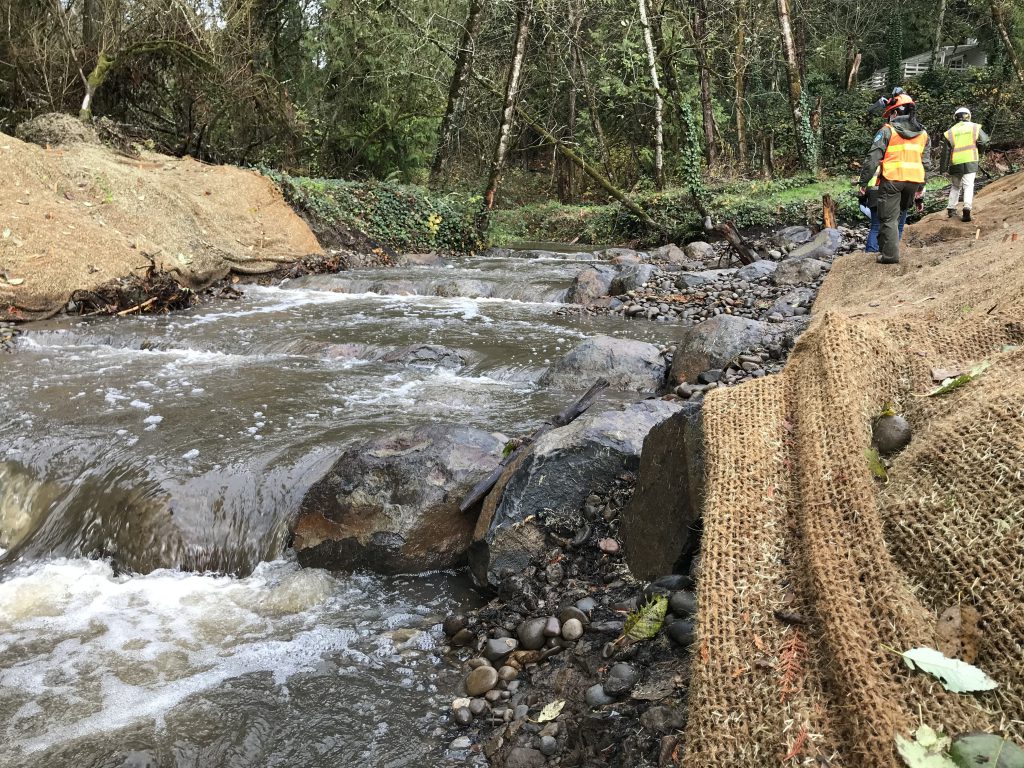
Along the main stem of Tryon Creek, weirs have been installed. The banks have coir matting which will be interplanted with native plants to stabilize soils and revegetate the creek corridor. 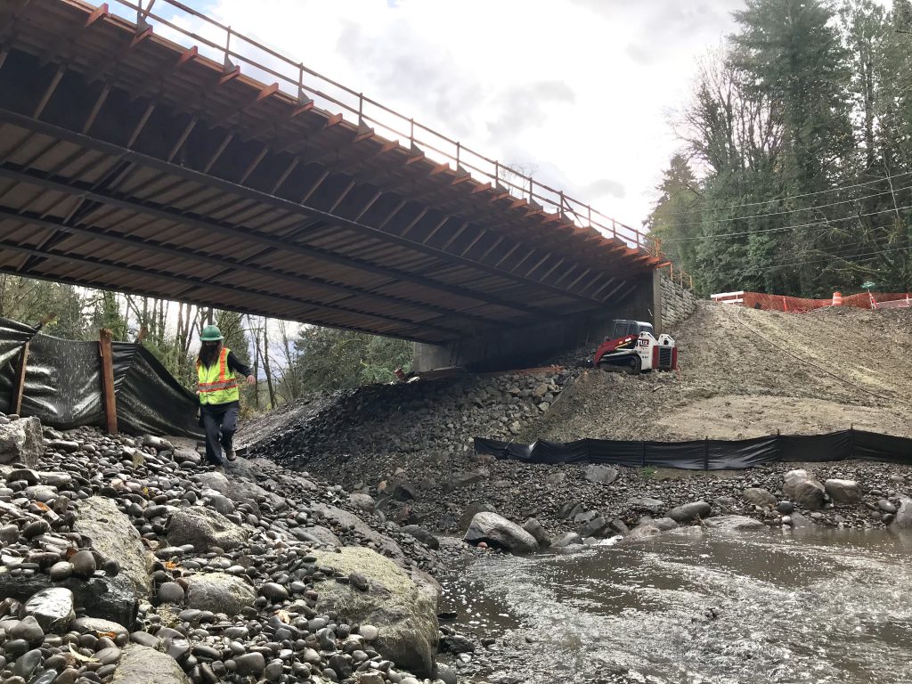
The main stem of Tryon Creek runs under the Boones Ferry bridge just past the confluence with Arnold Creek 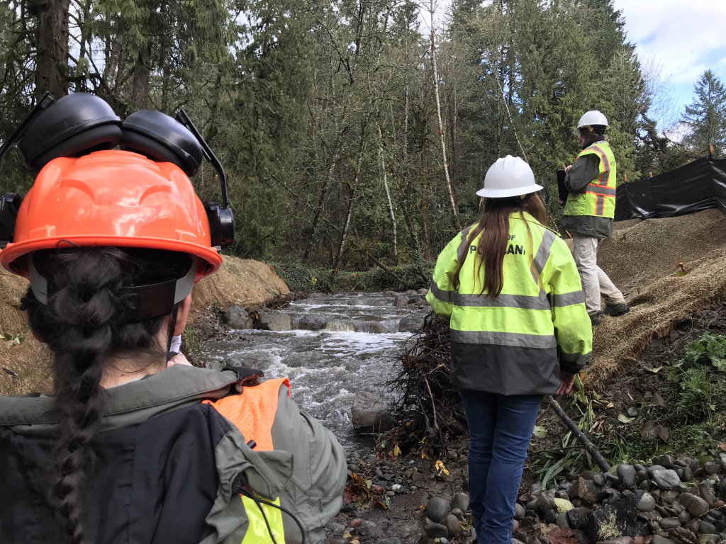
Along the main stem of Tryon Creek, weirs have been installed. The banks have coir matting which will be interplanted with native plants to stabilize soils and revegetate the creek corridor. 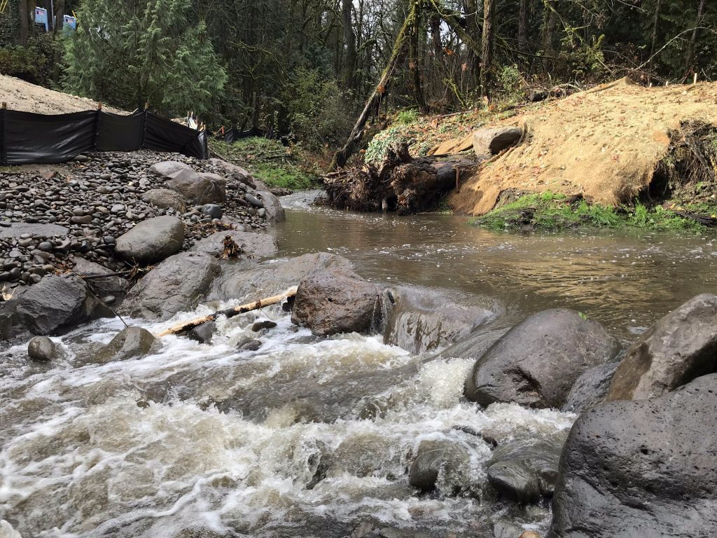
Arnold Creek (L) and main stem Tryon Creek (R) meet to flow under the Boones Ferry bridge 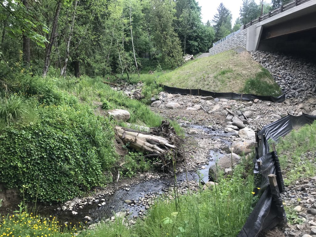
May 2021: Project completion! Planting at Boones Ferry Culvert Project with TCWC & FOTC. The view from the pathway near our project area, showing the confluence of Tryon and Arnold Creeks 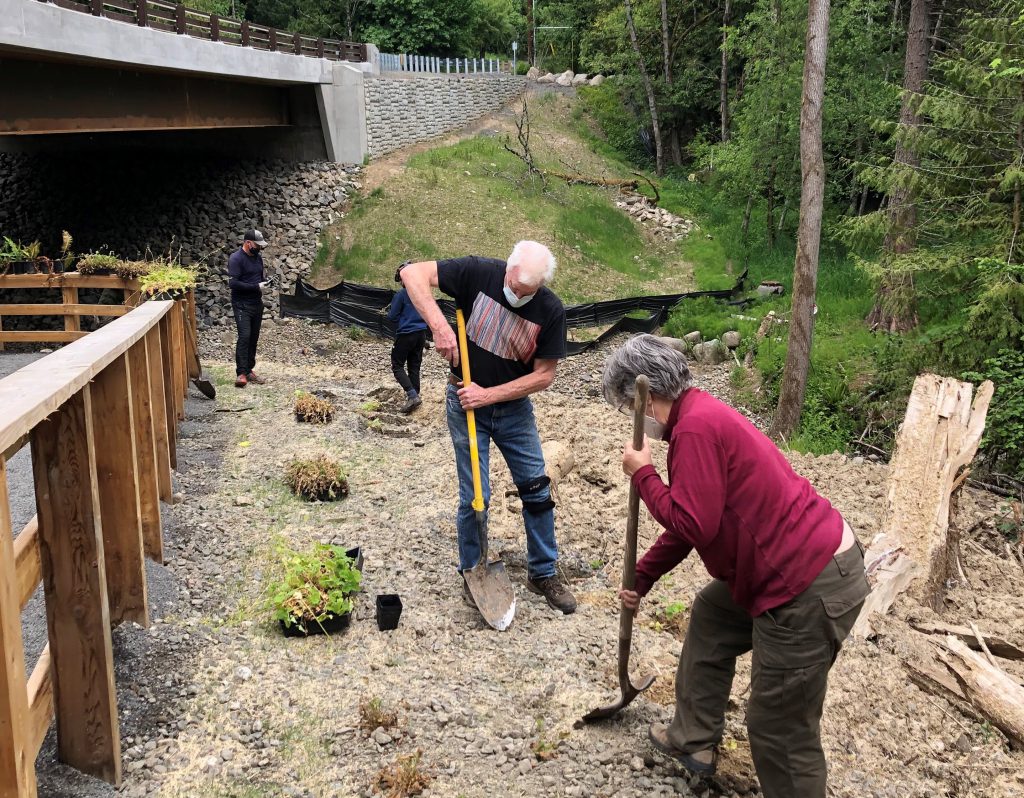
Rocky soil made for hard work – thank you, volunteers!! 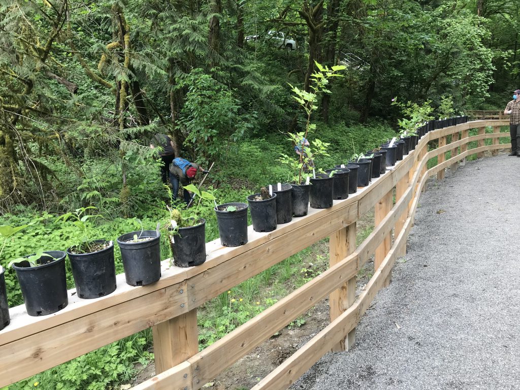
Believe it or not, the railing was lined with plants *twice*! 
View from the bridge of the work area (SW Arnold Rd is up to the left, & Arnold Ck to the right) 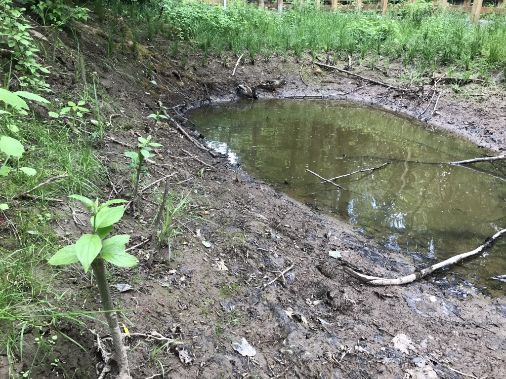
Willow stakes leafing out and ducks joined us for a while too 
Hardy natives like fringecup & geum were installed from 4″ pots 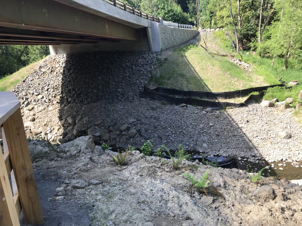
Some sword ferns were also installed 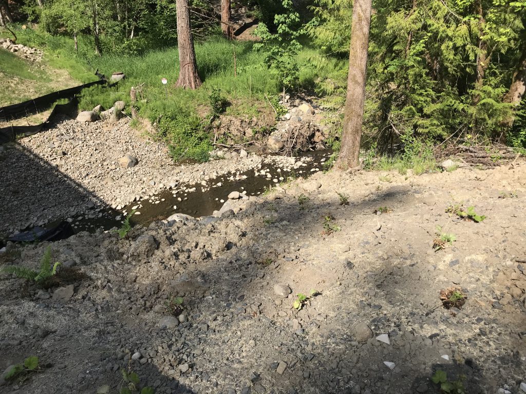
Note the biodegradable erosion control matting that is interplanted with native plants. 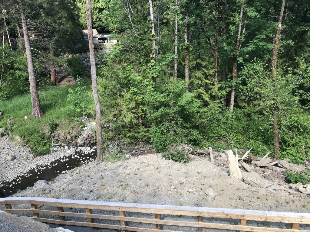
May 2022: 1 year post-project completion! BES staff provided a tour for TCWC & Cascade Education Corps, who replanted the slope above the wetland. 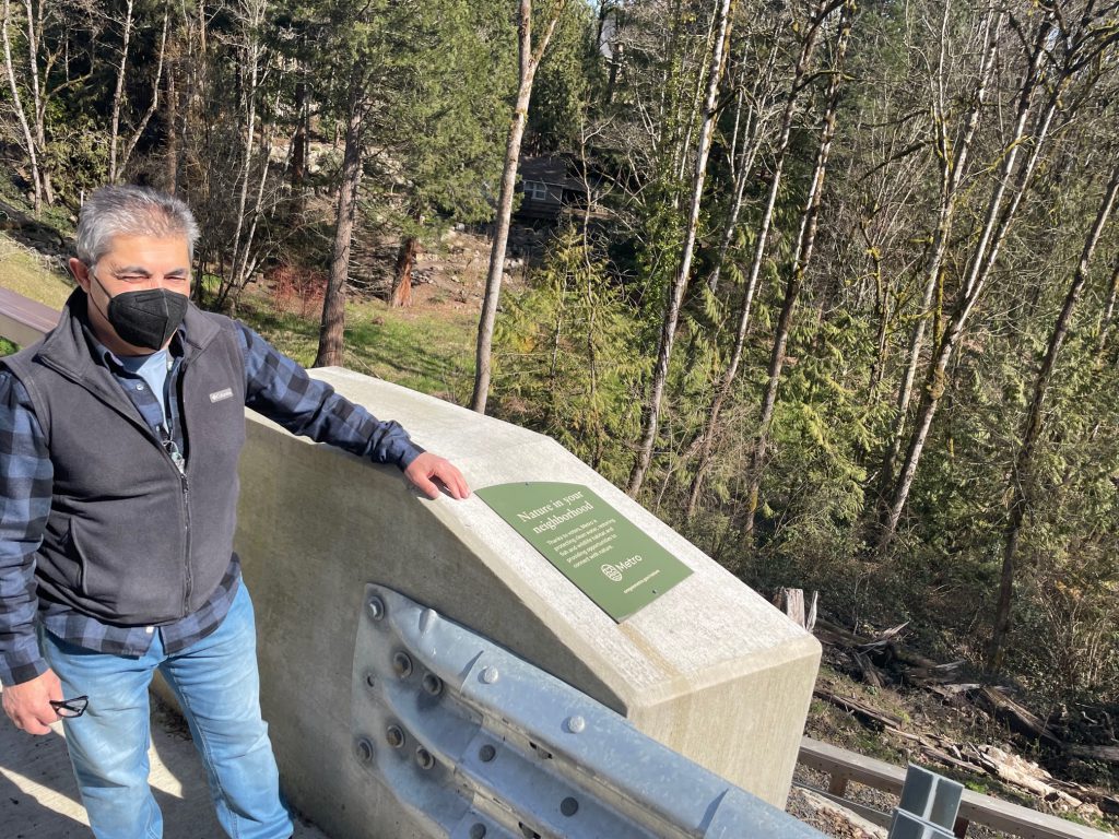
Amin Wahab from BES provided the tour 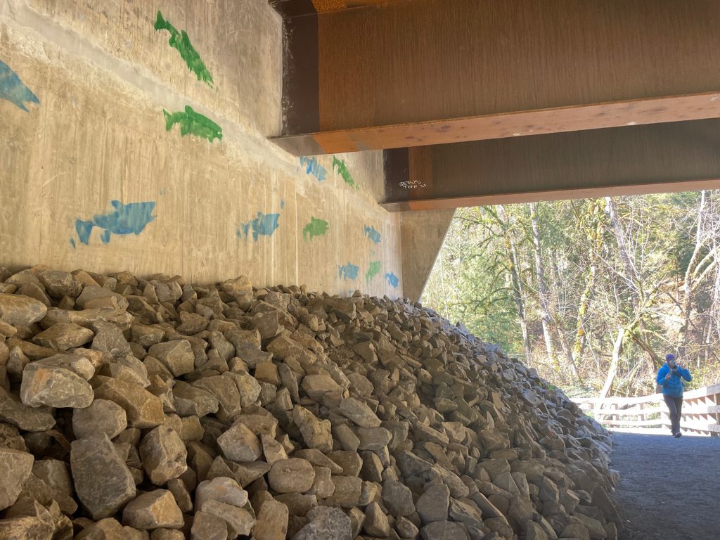
Fish art under the bridge 
Amin Wahab from BES provided the tour 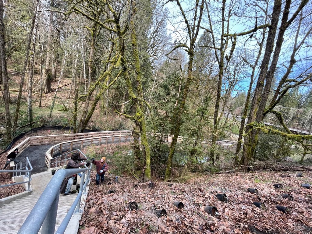
Cascade Education Corps students planting the slope above the wetland & project area, after the tour 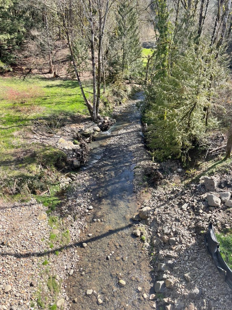
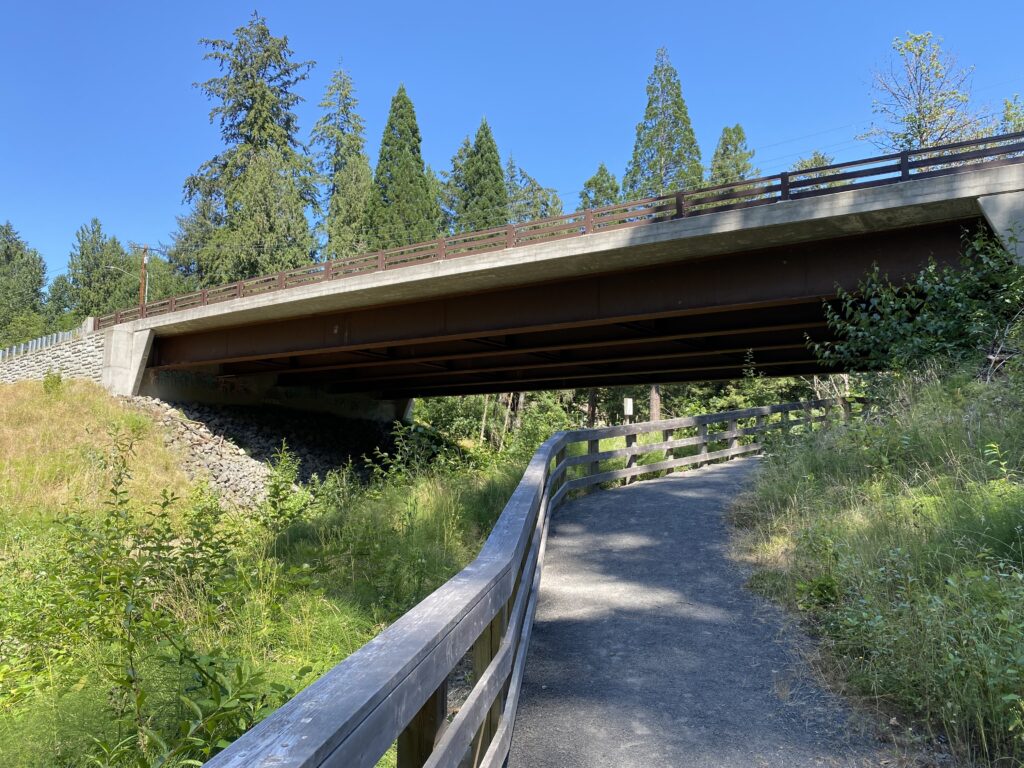
Looking downstream from the bridge 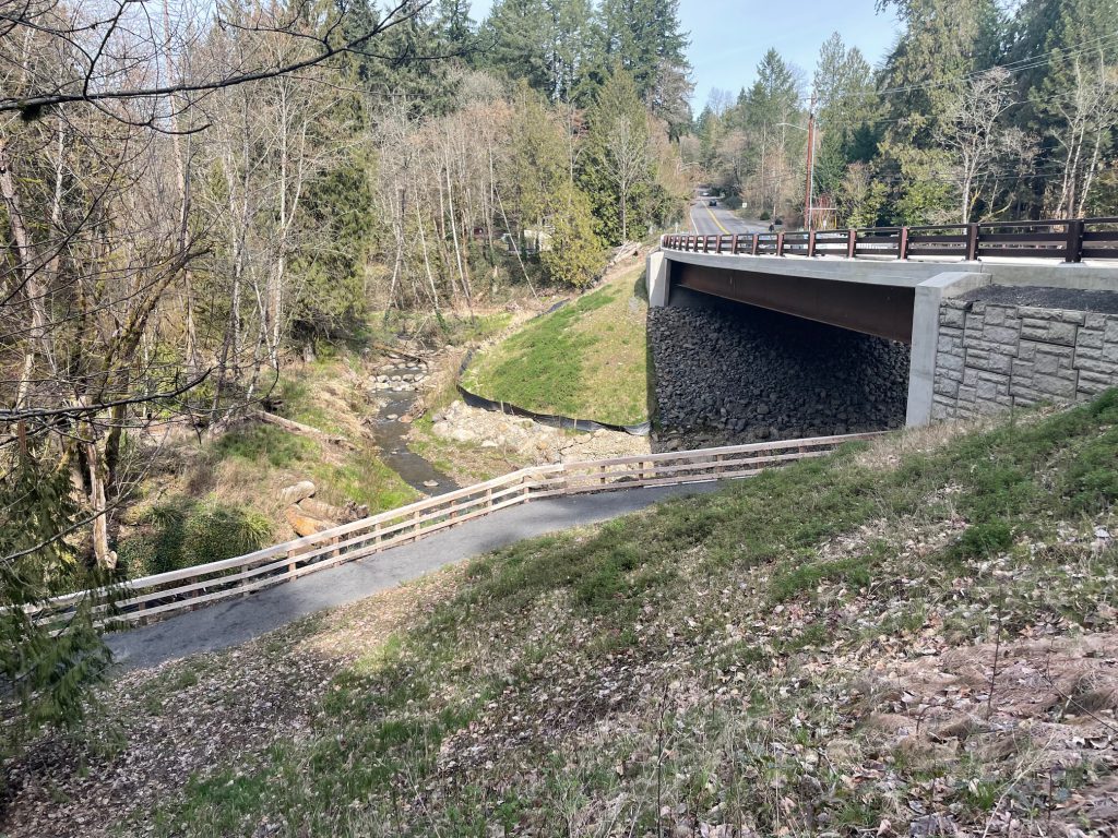
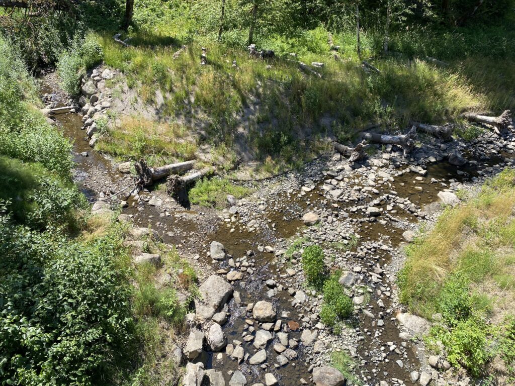
Confluence of Arnold & Tryon Creeks on-site 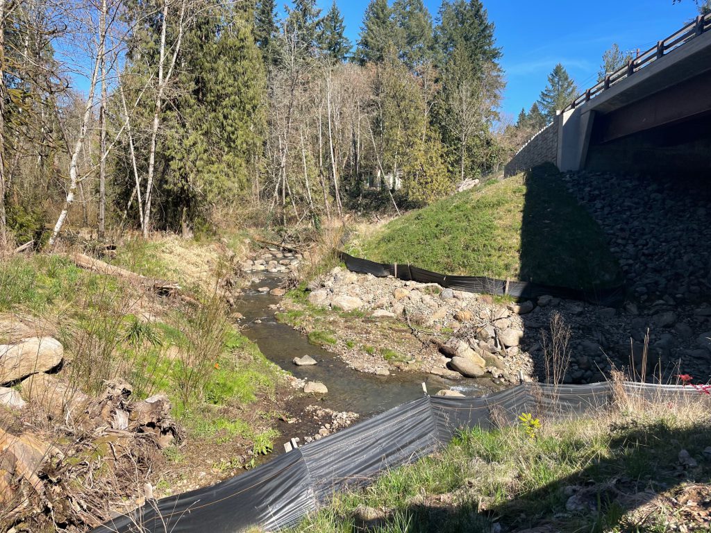
Confluence of Arnold & Tryon Creeks on-site
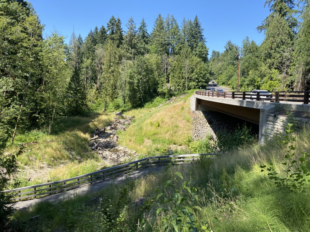
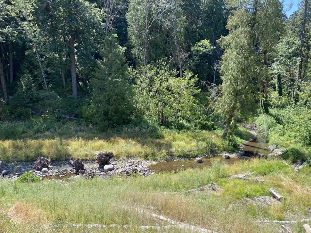
Boones Ferry Road Bridge (as of summer 2024):
4th Avenue/East Fork Culvert
Tryon Creek Watershed Council is working towards the removal of this barrier at the edge of the Tryon Creek State Natural Area.
Highway 43 Culvert
The Highway 43 culvert blocks fish passage about a quarter mile upstream from Tryon Creek’s confluence with the Willamette River. Efforts have been underway for over two decades to replace this culvert, a complicated and expensive project. Despite this culvert restricting fish access to the watershed, the Tryon Creek watershed supports a healthy coastal cutthroat trout population, and the lower portion of the creek below the Hwy 43 culvert is a cool water refuge for native fish off the Willamette River, including Chinook salmon, coho salmon, and Steelhead trout. Read the latest updates about the project on the City of Portland’s website, watch this video (from 2017!) to learn more about the importance of replacing this culvert, and read the Lower Willamette River Environmental Dredging and Ecosystem Restoration Project Fact Sheet for big-picture context.
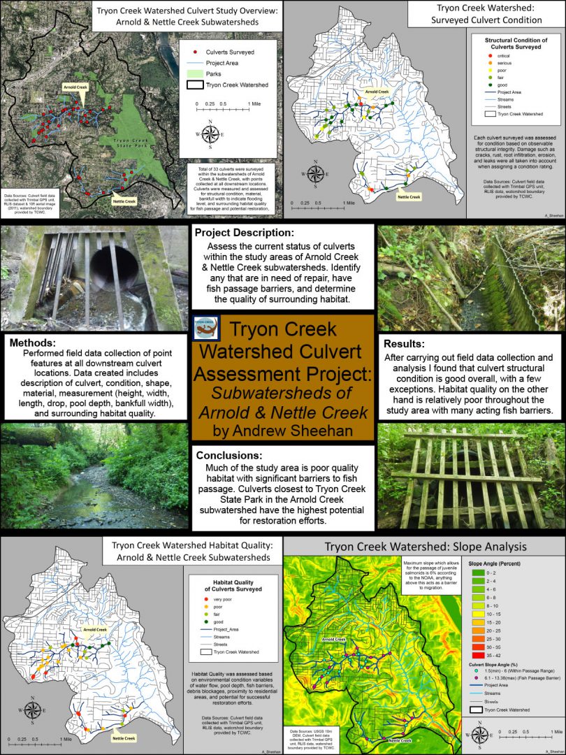
Tryon Creek Watershed Culvert Assessment Project poster
By PCC GIS student Andrew Sheehan. Click to view larger.
Note that TCWC is beginning a Rapid Bioassessment in Fall 2024, which will assess watershed conditions & highest priority projects for TCWC to pursue.